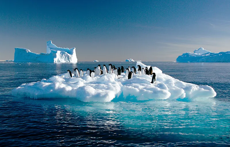
Unlike its fellow penguins, the Antarctic penguin prefers to use giant icebergs for travel rather than travel long distances on foot on land.
The Southern Ocean is located on the southern hemisphere of the Earth and surrounds Antarctica. It washes the shores of South America, Australia, New Zealand, and South Africa. The Southern Ocean is the youngest of all the oceans and was only recognized by the international community in 2000.
The Southern Ocean covers about 20 million square kilometers and is the coldest and smallest of all the oceans. It contains about 15% of all the water on Earth and has an average depth of about 4,000 meters. The Southern Ocean is home to many species, including whales, penguins, crabs, squid, and many others.
The Southern Ocean is an important research site for scientists because it provides unique opportunities to study climate change and the marine ecosystem. The ocean also plays an important role in regulating the Earth’s climate because it absorbs significant amounts of carbon dioxide from the atmosphere.
Fifth Ocean
The Southern Ocean refers to the part of the world’s ocean that encompasses the waters of the Pacific, Indian, and Atlantic Oceans surrounding Antarctica.
The Southern Ocean was formed about 30 million years ago when South America separated from Antarctica by forming the Drake Passage.
The Southern Ocean is rich in plankton and krill, the primary dietary components of whales. One of the most common species of whales in the Southern Ocean, the humpback whale, is also one of the most mobile whales, who loves to do spectacular acrobatic tricks, high jumping out of the water.
Cape Horn is an extremely unfriendly place, it is windy and overcast all year round. It is the southernmost point of the Tierra del Fuego archipelago, washed by the waters of the Drake Passage. This strait is a natural water boundary between the Atlantic and Pacific Oceans and, at the same time, part of the waters of the Southern Ocean. In some countries, latitude south of Cape Horn is considered the boundary of the Southern Ocean.
On most nautical charts there is no such concept as the Southern Ocean at all. Seafarers also do not use it for practical purposes. Moreover, there is no scientific consensus on the exact definition of its boundaries.
The boundaries of this ocean are extremely tentative, because the very definition of the location of the ocean is also in question. As a separate ocean, it was mapped as early as 1650 by the German-Dutch geographer Bernhard Waren, also called Bernhardus Warenius (1622-1650). In the last year of his life, Varenius published his major work General Geography: A General Scientific Systematized Description of the Earth’s Surface, in which Varenius sought to bring together all of the geographic knowledge accumulated by humankind at the time.
The reason Varenius combined the Antarctic regions of the three oceans into one, the Southern Ocean, was because Antarctica had not yet been discovered, as well as all other areas above the South Polar Circle.
In 1845, the Royal Geographical Society in London attempted to introduce the name “Arctic Ocean,” but it did not catch on.
The Southern Ocean was present on geographical maps until the beginning of the 20th century. In 1937, the International Hydrographic Organization used the name “Southern Ocean” in a number of publications. Moreover, many editions of geographical atlases referred to the Southern Ocean and the territory of the ice-covered continent Antarctica. At the same time the latitude of the South Polar Circle (66°33’44” S.) was considered as the border of the Southern Ocean.
By the beginning of the 20th century the southern regions of the three oceans had already been sufficiently explored, and scientific discussions regarding the boundary of the Southern Ocean began. Each science saw its own way of determining the ocean boundary as the only correct one. Hydrologists and climatologists determined the boundary of the Southern Ocean on the basis of atmospheric and water circulation: 35°E. Marine geologists, having studied the nature of the seabed, insisted on the boundary at 60°S. Oceanologists of the USSR, when compiling the Antarctic Atlas in 1969, determined the boundary of the Southern Ocean at 55°S – the northern boundary of the Antarctic convergence zone (the zone of convergence of northern, relatively warm, and southern, cold surface waters).
In 2000. The International Hydrographic Organization adopted a division into five oceans, but this decision was not finally ratified.
Since the designation of a separate ocean had no practical value, the issue of the Southern Ocean gradually disappeared from the practice of navigation, it ceased to be mentioned in maritime manuals. Today, the topic of the Southern Ocean is sometimes raised by scientists specializing in very narrow branches of oceanology.
The question of the boundary of the Southern Ocean has remained controversial, but as a compromise, most specialists place the northern boundary at 60°S, and the southern boundary at the coast of Antarctica. Accordingly, the Southern Ocean can be considered the fourth largest by area.
Geography
The Southern Ocean is located in the southern polar region of the Earth. Most often this is the name given to the southern parts of the Atlantic, Indian and Pacific Oceans, adjacent to Antarctica. The coast of Antarctica is considered to be the southern boundary of the ocean, while the northern boundary is conventionally drawn approximately along the parallel of 60°S. The northern boundary of Antarctic surface waters (the Antarctic Circumpolar Current) is located here (or more precisely to 55°S.).
“Roaring Forties” is the name given by sailors to the oceanic space between 40° and 50° latitude in the southern hemisphere of the Earth, where strong and persistent westerly winds constantly blow, causing frequent storms.
A distinctive feature of the Southern Ocean is the atmospheric circulation of air masses, moving a considerable distance over the open ocean, never encountering barriers in the form of mountains or large areas of flat land.
Intensive cyclonic activity is extremely well developed over the Southern Ocean. Most cyclones move from west to east. This zone falls within the area between the 60th and 70th parallels of the southern latitude, called the “howling sixties” due to the strongest winds constantly prevailing in this region, reaching speeds of 145 km/h and raising waves 15 m high and higher.
Another distinctive feature of the Southern Ocean is the Westwind Current, which spreads throughout the water column and carries it in an easterly direction. To the south of this current, the Western Coastal Current is formed. Cold and dense water masses formed here move from the shores of Antarctica along the ocean floor far to the north.
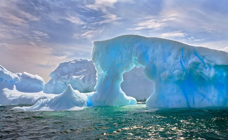
It is here, in the Southern Ocean, that the largest icebergs are formed, constantly breaking away from the Antarctic ice sheet. At the same time there are more than 200 thousand icebergs in the Southern Ocean. The average length of an iceberg is about 500 meters, but colossal icebergs up to 180 km long and several tens of kilometers wide can be found. Currents carry icebergs northward, and they can even reach 35-40° S: a significant mass melts under the sun for a long time. The average age of an iceberg in the Southern Ocean is 6 years, but there are also “veterans” 12-15 years old.
Flora and fauna
The climatic conditions for the flora and fauna of the Southern Ocean only seem harsh. On the contrary, plants and animals have perfectly adapted to use the cold as a protective element. The Southern Ocean is characterized by giant clusters of phyto and zooplankton, krill, and many species of sponges and echinoderms live on the bottom. There are several families of fish, but notothenia fish predominate.
Birds are very peculiar: the southern giant petrel, black-browed albatross, and skua are able to travel long distances by air, and the flightless penguin – on foot on the ice. The abundance of food explains the exceptional species diversity of whales (blue whale, fin whale, seiwhale, humpback whale) and seals (Weddell seal, crab seal, sea leopard, harbor seal). Industrial cetacean fishing has seriously reduced their numbers, and whaling is now prohibited. Other dangers threatening the numbers of local fauna include poaching overfishing, and the breeding of rats on Antarctic islands, where the number of bird nesting sites is very high.
Population
On the islands and continental coast of the South Sea, the population is inconstant and small: these are primarily polar explorers. Other settlers, according to the Antarctic Convention, cannot be there, as the continent and islands south of 60°S cannot belong to any state, and only scientific activity is allowed there. Unfortunately, it doesn’t mean that the convention signatory states have no territorial claims: Great Britain, Norway, Australia, Great Britain has had a claim on the South Shetland Islands since 1908, Chile since 1940, and Argentina since 1943. The United States and Russia also have claims to the South Shetland Islands. Since 1929, Norway has a claim to Peter the Great Island. There are a number of other disputed islands in the Southern Ocean, but all of them have no permanent population, and only in summer do scientific expeditions visit the islands.
General Information
- Location: Southern Hemisphere.
- Composition: water area around Antarctica (southern areas of the Atlantic, Indian and Pacific Oceans).
- Seas: Atlantic Ocean (Lazarev, Riiser-Larsen, Skosh, Weddell), Indian Ocean (Davis, Cosmonauts, Mawson, Commonwealth), Pacific Ocean (Amundsen, Bellingshausen, D’Urville, Ross, Somov).
- Geographic boundaries: north – 60° S., south – coast of Antarctica.
- The largest islands: Rossa, Adelaide, archipelagos: Palmera South Shetland Islands, South Orkneys Islands, including the largest islands in Antarctica completely surrounded by ice shelf: Alexander’s Land, Berkner, Thurston.
- Area: 20.327 million km2.
- Average depth: 3500 m.
- Maximum depth: South Sandwich Trench (Atlantic Ocean, 8428 m).
- Antarctic shelf depth: up to 500 m.
- Area of ice cover in September-October: 1819 million km2, in January-February – 2-3 million km2.
- Average width of the drifting ice belt: in November at 30°W. – 2,000 km in November, at 170°W, 1,500 km at 90-150°W. – 1 500 km, at 90-150°E. – 250-550 km.
Climate and weather
- Sea Antarctic.
- Mean temperature in January: near shores of Antarctica does not exceed 0°C (-6°C in the Weddell and Ross Seas); at 50° S. it rises up to +7°C in the Indian and Atlantic Oceans and up to +12°C in the Pacific Ocean.
- Mean temperature in July: near the Antarctic coast – 20°C (in the Weddell and Ross Seas – 30°C); at 50° S. -2 – 3°C in the Atlantic and Indian Oceans, and -6-7°C in the Pacific.
Economy
- Sea shipping.
- Sea fishing.
- Services: tourist and transport.
Attractions
- Ross Ice Shelf Glacier.
- Una Peaks (Le Maire Canal).
- Banger Oasis (western part of the Wilkes Land)
- Pillar-shaped icebergs
- Bird colonies
Fun Facts
- The 60th parallel of southern latitude is not only the northern boundary of the Southern Ocean, but also the northern boundary of the demilitarized zone free of nuclear weapons (Antarctic Treaty of 1959).
- In the Northern Hemisphere 61% of the Earth’s surface is occupied by water, and in the Southern Hemisphere – 81%.
- In the Southern Ocean there are sectors: the Atlantic Ocean – between the northern tip of the Antarctic Peninsula and the meridian of the Cape of Good Hope, the Indian Ocean – between the meridian of the Cape of Good Hope and the meridian of the South East Cape on Tasmania Island, and the Pacific Ocean – between the meridian of the South East Cape on Tasmania Island and the northern tip of the Antarctic Peninsula.
- The South Sandwich Trench is not only the deepest in the Southern Ocean, but also the second deepest in the Atlantic Ocean – after the Puerto Rico Trench (8742 m).
- Most of the Southern Ocean fauna species living in water temperatures close to freezing (up to -1.9°C) have in their blood and other body fluids a kind of automobile “non-freezing agent”: glycoproteins – a special compound of sugars with proteins that prevents the formation of ice in the body.
- The gray-headed albatross is listed in the Guinness Book of Records as the bird with the fastest horizontal flight: 127 km/h, the speed the albatross maintained for more than 8 hours while returning to its nest on South Georgia Island. The wandering albatross there also has the largest wingspan of any bird: up to 325 cm.
- Another record-breaking Antarctic bird is the Papuan penguin from the Falkland Islands, which reaches a speed of 36 km/h underwater and is the fastest of all penguins.


