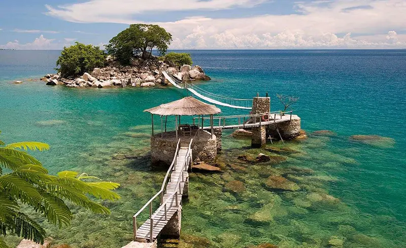
Lake Malawi, aka Lake Nyasa, is the southernmost lake of the Great Rift Valley in East Africa. It fills a chasm in the Earth’s crust, at the edges of which are now the states of Malawi, Mozambique and Tanzania.
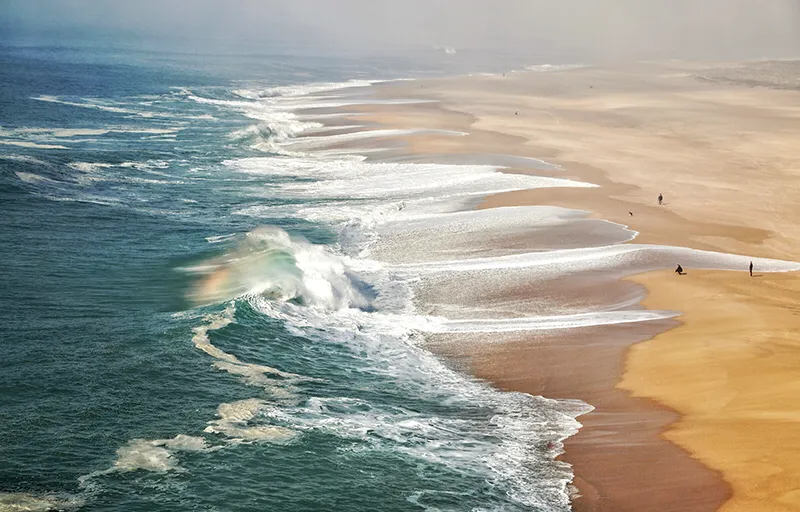
Of all the African Great Lakes, Nyasa is distinguished by its beautiful beaches. Nyasa is very popular with water sports enthusiasts, including the so-called “sailing safari” that takes place on Nyasa and Lakes Malombe and Amaramba.
East African Lake
The lake was formed by the filling of a meridional depression created by ancient tectonic movements of the Earth’s crust. The bottom of the lake is covered with a thick layer of sedimentary rocks – up to 4 km thick, which indicates that the lake is several million years old.
Its depth increases from south to north. In the northernmost part of the lake, the slopes of the mountains go steeply straight into the water, clearly demonstrating the tectonic nature of its origin. The farther south, the wider the coastal plain and farther away from the shore are the mountains that represent the boundaries of the Great Rift Valley. The highest up to 2,000 meters are the Livingstone Mountains, located in the northeast and cut through by the Ruhuhu River.
The Ruhuhu is the longest of the rivers that flow into Lake Nyasa. The river is full all year round, it never dries up and its water makes up 20% of the total water in the lake. The only river that flows out of the lake is the Shire. The outflow through the Shire River depends on the water level in the lake, which varies within 6 meters. A barely perceptible increase in rainfall relative to evaporation leads to catastrophic flooding, and when this factor decreases, the lake level drops and the flow through the Shire River stops. Such phenomena are observed every eleven years.
Lake Nyasa contains a gigantic volume of water, but the total runoff is relatively small: about 63 km3 of water enters the lake each year, but only 16% leaves the lake through the Shire River, with the rest evaporating from the surface. That’s why Lake Nyasa has an incredibly long water renewal period: all of it is replaced within 114 years. Because most of the water evaporates, the water in the lake is brackish, with a higher mineral content than the water in the rivers that flow into it.
But this makes Lake Nyasa extremely sensitive to pollution. The fact is that dissolved substances in the water do not evaporate and do not fall to the bottom, and once in the lake, will leave it in the form of runoff only after 650 years.
History
In the language of the Yao people who have long inhabited the lakeshores of western Malawi, “Nyasa” simply means “lake”. But it has many other names.
Europeans have known about the existence of a huge lake in Central Africa for a long time. Already in the XVII-XVIII centuries. contours of the lake were drawn on maps from the words of Arab traders. At that time it was known as Zaflan, Zambre, Chemozura and Marawi.
In 1859, the famous African explorer David Livingstone explored the Shire River and traveled along it to the southern shore of Lake Malawi. The poetically inclined Scotsman called Nyasa “Lake of Stars”: the sun played so brightly with its rays on the water surface. But on the map he labeled it as Lake Nyasa. In 1964 Nyasaland, a former colony of England, gained independence and began to call itself Malawi, and the lake as Lake Malawi. But the people of Mozambique call it Niassa, in the Portuguese manner.
The figurative name “Lake of Storms” is widespread among local peoples: real storms – sudden and violent – often occur here. Here they are called mweru, as is the hurricane wind that causes them.
Population
Lake Nyasa straddles the borders of three African countries: Malawi, Mozambique and Tanzania. The northern part of the lake is a territory of conflict: the dispute over the distribution of lake waters between Malawi and Tanzania is still unresolved.
The lake receives water from half a dozen rivers, and flows out of it one single river – the Shire, on which a large hydroelectric power plant was built.
The population of the lakeside states is growing rapidly. The main source of life in these places is Lake Nyasa. But can it feed millions of people?
The southern shore of the lake is the most populated. Three quarters of the population is engaged in agriculture, which accounts for an impressive part of the gross product of the countries surrounding the lake, and most of the harvest is exported The northern coast is sparsely populated, covered with jungle and practically not used in the economy.
There are only two large inhabited islands on the lake – Chizumulu and Likoma. On the latter stands the stone Anglican Cathedral of St. Peter, built by European missionaries in the early XX century.
On the Shire River there is a hydroelectric power station, the main source of electricity for the local population. Due to periodic fluctuations in the lake level and the unstable flow of the Shire River, the economy of the surrounding countries suffers significant losses.
The local population is mainly engaged in fishing and tourist services. Fishermen catch approximately 7,000 tons of fish per year. The bulk of the catch – fish species called utaka, chisawasawa and chambo – is subsequently eaten dried and some is exported.
The size of the catch is steadily declining year by year due to overfishing and the use of prohibited means to catch small fish, resulting in the death of juvenile fish. There is hope for big catches away from the coasts, where huge schools of fish are found in deep water. But even the local authorities are convinced that at the current rate of population growth, this no longer seems like salvation.
There are several tourist steamers of solid years plying the smooth surface of the lake – some are well over half a century old, but they have perfectly preserved their navigable qualities.
Flora and fauna
A distinctive feature of the islands is a large number of huge baobabs, some of which reach 30 meters in diameter, and the age of more than two thousand years Locals eat their fruits and make crafts from them for tourists. Local tribes still build rectangular huts with thatched roofs in the same old way.
Lake Nyasa is the first in the world in terms of diversity of fish stocks: up to 1000 species of fish live here. The overwhelming majority – up to 90% are cichlids: fish from the perch group. Predatory species stay away from the shore, in deep water; others live in the coastal zone. Here they are numerous, and a large part of them are endemics.
Cichlids are the main object of the lake fishery; they provide food for a significant part of the population of Malawi. A special item in the local economy is ornamental fish species, which are exported to aquarists. These colorful fish are either caught or bred in special cages.
The local fauna is characterized by the presence of large numbers of crocodiles and hippos. The abundance of fish has led to the establishment of a stable population of African wedge-tailed eagles, whose diet is based on fish. Along the northern shore of the lake there are dense papyrus thickets, where kingfishers and cormorants, which also feed exclusively on fish, nest.
A phenomenon unique to Lake Nyasa is the annual mass departure of lake flies, whose larvae live on the bottom in the shallow parts of the lake. On such days, myriads of these insects rise into the air, cover the sun and daylight fades.

General Information
- Africa’s third largest lake, ninth largest in the world.
- 7% of the world’s liquid freshwater reserves.
- Origin: tectonic.
- Category: effluent.
- Islands: Likoma, Chizumulu (both in Malawi).
- Countries on the lake shore: Malawi, Mozambique, Tanzania.
- Languages: English, Nyanja, Chichewa (Malawi), Portuguese, Makua (Mozambique), Swahili (Tanzania).
- Monetary units: Tanzanian shilling Mozambique metical, Malawi kwacha.
- Ethnicity: Chewa, Nyaja, Malawi (Malawi), Yao, Makhuwa, Tsonga (Mozambique), Bantu (Tanzania).
- Religions: Christianity, Islam, aboriginal cults.
- Major population centers: Manki Bay, Chipoka, Nkhotakota, Nkata Bay, Karonga (Malawi), Manda (Tanzania), Kobwe (Mozambique).
- Major outflowing rivers: Ruhuhu, Songwe, North and South Rukuru, Dwangwa, Bua, Lilongae.
- Largest outflowing river: Shire.
- Surface area: 29,600 km2.
- Catchment area: 6,593 km2.
- Length from north to south: 560-580 km.
- Maximum width: 75 km.
- Mean depth: 292 m.
- Maximum depth: 706 m.
- Elevation above sea level: 472 m.
- Water volume: 8400 km3 (fifth largest volume in the world).
- Coastline length: 1245 km.
- Transparency: 13-23 m.
Economy
- 80% of the population is engaged in agriculture.
- Agriculture: grain crops, cattle breeding.
- Fishing and fish processing.
- Export of ornamental fishes.
- Lake navigation. HYDROELECTRIC POWER STATION.
Climate and weather
- Equatorial.
- Mean annual temperature: +20ºС – +27ºС.
- Water temperature at the surface: +24ºС – +29ºС.
- Water temperature at a depth of 3 meters: +22ºC.
- Average annual precipitation: up to 2000 mm.
Attractions
- Likoma and Chizumulu Islands (Malawi)
- Nkata Bay Town (Malawi)
- St. Peter’s Anglican Cathedral (Likoma Island, Malawi, early 20th century).
- National Parks: “Lake Malawi”, “Liwonde” (Malawi)
- Monkey Bay Town (Malawi)
- Cape Maclear (Malawi)
Fun Facts
- Traditional Malawian religions consider Lake Nyasa to be the “source of all life”.
- The steamer Chancy Maples has been plying the waters of Lake Nyasa since 1901. Previously, it was a floating hospital and church on the water of a European mission in Africa.
- In fact, it was not David Livingstone who discovered Lake Nyasa to Europeans. The first of the Europeans saw this lake in 1616, the Portuguese traveler Gashpar Bucarro But information about his discovery was lost in the Portuguese state archives, and the name of the pioneer was long forgotten.
- The border between Malawi and Mozambique runs in the middle of the lake, while the border between Malawi and Tanzania runs along the eastern shore.
- On August 16, 1914, the only water battle in its history took place on the lake. The British gunboat Gwendolen, commanded by Captain Rhodes, was ordered by the British Admiralty to “sink, burn or forfeit” the ship Hans von Wiseman, the only German gunboat on the lake. The British fired only one cannon shot from a distance of 1800 meters and it was successful. It was the first victory of the British navy in the First World War.
- The waters of the lake can be roughly divided into three layers based on the density of the water, which is due to the temperature.
- The hyena dog, a unique animal that lives on the shores of Lake Nyasa, was long thought to have disappeared in Malawi, but scientists have managed to find a few individuals. As it turned out, the animals regularly cross the Malawi-Zambian border to hide from poachers.


