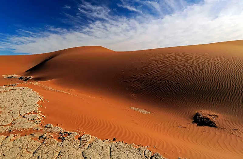
The Great Rift Valley (or Great Rift) is a vast geologic structure that is a system of tectonic faults that extends vast distances across East Africa and Asia. The valley was formed by the movement of lithospheric plates and active volcanism.
East African Rift Valley
The Great Rift Valley (East African Rift Valley) is a large rift relief formation extending through northern Ethiopia to the central provinces of Mozambique, dipping deep into East Africa. The Great Rift Valley’s outline resembles a crudely made slingshot.
The Great Rift Valley is considered the cradle of mankind, as some of the oldest remains of the ancestors of modern man have been found here. In particular, finds in the Olduvai Gorge (Tanzania) and the Lake Turkana region (Kenya) have provided important data on early human evolution.
Geography and history of formation
This immense formation was named in the late 19th century by the English geologist and explorer John Walter Gregory (1864-1932), who was famous for his studies of the geography and geology of East Africa and Australia. The eastern branch of the Great Rift Valley, stretching from the Red Sea coast to Lake Nyasa, was named Gregory’s Rift in honor of the scientist himself. The short western branch is known as the Albertine Rift.
The Great Rift Valley was formed by tectonic activity at the boundary of the African and Arabian tectonic plates. The northern part of the valley filled with water and the Red Sea was formed.
Rift – an elongated depression in the Earth’s crust, usually of very large size, created along a fault line in the Earth’s crust when tensile or longitudinal forces act on it – both in the oceans and on land. It is correct to speak about the East African rift system, because in its different parts and on its different parts there is expansion and contraction of the continental zone of the Earth’s crust. In the rift system there are also such areas where the oceanic crust is already forming. An example of such a section of the Great Rift Valley is the Ethiopian Afar Valley, located in the north of the rift zone.
As a result of continuous movement of the Earth’s crust, the deepest depression in Africa was formed here, falling to one and a half hundred meters below sea level. Relief features in conjunction with climatic features formed here one of the hottest places on earth: the average minimum temperature of the Afar Valley +25 ° C, the maximum +35 ° C, and precipitation falls about 200 mm per year. The depression was formed about 1.5-2 million years ago, at the beginning of the Quaternary period. Along the border of the depression are the tops of volcanoes, including active ones, such as the Dabbahu volcano (1442 meters), known for the fact that its eruption in 2005 and the earthquakes that preceded it led to the formation of a crack in the Earth’s crust – the “Dabbahu fault”. Researchers believe that it is this crack that shows the direction that the Somali tectonic protoplate will separate from the African protoplate, eventually dividing the African continent.
The Afar Valley, or Afar Basin, is otherwise known as the “tectonic triangle”: the Red Sea Rift, the East African Rift and the Aden Ridge converge here. This basin, where there is constant tectonic movement (1-2 cm/year), remains the second place in the world (apart from Iceland) where ocean ridges can be studied directly on land. The Afar Basin is famous for perhaps the most unique volcano on earth – Erta Ape, this shield volcano, the most active in Ethiopia (notably, it has been continuously active since 1976), is the only one in the world to possess two lava lakes.
Within the Great Rift Valley lies Africa’s highest peak, Kilimanjaro, and the enormous volcanic caldera of Ngorongoro (Tanzania), resulting from the collapse of a large volcano 2.5 million years ago. The crater is 610 m deep, 17 to 21 km in diameter, with a total area of about 265 km2.
The Great Rift Valley region is home to many volcanoes, the highest of which are the extinct Kenya, Kilimanjaro and Elgon. In addition, one example of a large cluster of these amazing natural formations is the Volcanoes National Park in northwestern Rwanda, within which Karisimbi, Bisoke, Muhabura, Gahinga and Sabinyo are located.
Modern science links the initial stages of the evolution of the human branch of hominids to the Great Rift Valley. In particular, the Afar Basin is known as the site of the oldest human remains – Australopithecus afar, who lived about 4 million years ago. In 1913, the German geologist Hans Reck first explored the Olduvai Gorge west of the Giant Crater Highlands in Tanzania. The scientist brought from there to Berlin a large collection of fossil mammal remains. In 1928, the English anthropologist Louis Leakey (1903-1972) examined the collection and discovered that some of the materials Rehk had brought back were artifacts – objects of artificial origin. Leakey traveled to Olduvai Gorge, but it wasn’t until 1959 that he found the skulls of the predecessors of modern man, including those belonging to the genus homo. Leakey called it homo habilis – “skillful man”. Later were found other remains of hominids, ranging in age from 500 thousand years to 1.8 million years.
According to scientists’ calculations, in the future across the fault East Africa will separate from the main part of the continent, forming an island that will head towards the Arabian Peninsula. When the Arabian Peninsula collides with the East Africa island, mountains will form and the Red Sea will become three times longer. Scientists say that this is certain to happen in 3-4 million years, and the main fault line will stretch exactly along the current Great Rift Valley. Researchers are confident that Africa is splitting at a rate rarely seen in geology.
The Great Lakes of Africa
The Great African Lakes are natural elements of the rift system formed during the geologic formation of the Great Rift Valley.
Tanganyika is the world’s longest freshwater lake: it is about 700 kilometers long. Lake Victoria, located in the tectonic trough of the East African platform, between the western and eastern branches of the rifts, is the second largest freshwater lake in the world (after Lake Superior): 68,000 km2. Nyasa is the third largest and southernmost of the Great Rift Valley lakes, filling a deep meridional depression in the Earth’s crust between Malawi, Mozambique and Tanzania for almost 600 km. The sediments at the bottom of the lake are up to 4 km thick: the lake is several million years old. Lake Edward is the smallest of Africa’s Great Lakes, which in the 1970s had the dubious honor of being temporarily renamed after Uganda’s brutal dictator Idi Amin. The other lakes are Albert, Kivu and Rudolph (Turkana).
Nature
The areas through which the Great Rift Valley runs are the richest in flora and fauna in all of Africa. The world-famous Wurunga (Democratic Republic of Congo), Ruwenzori, Queen Elizabeth (Uganda) and Volcanoes National Park in Rwanda have been established to protect wildlife. Of world significance is the Serengeti ecosystem, one of the oldest protected areas and best preserved on earth. More than 80% of the Serengeti is covered by protected areas: the Serengeti National Park, the Ngorongoro Conservation Area in Tanzania, and the Masai Mara Conservation Area in Kenya.
General Information
- Location: East Africa.
- Countries and territories (from south to north): Mozambique, Malawi, Tanzania, Zambia, Democratic Republic of Congo, Burundi, Rwanda, Uganda, Kenya, Ethiopia, Eritrea, Djibouti, Somalia.
- Major rivers: Congo, Zambezi, White Nile.
- Major lakes: Nyasa, Tanganyika, Victoria, Edward, Albert, Kivu, Rudolph.
- Mountain systems: Ethiopian Highlands, Ruwenzori mountain range, Virunga Mountains, Itombwe Mountains, Aberdare Range.
- Length (from south to north): about 6000 km.
- Width: from 30 to 100 km.
- Depth: from several hundred to thousands of meters.
- Highest point: Mount Kilimanjaro (Tanzania, 5895 m).
- Lowest point: -153 meters (Afar Valley).
- Other peaks: Mount Ras Dashen (Ethiopia, 4620 m), Mount Kenya (Kenya, 3825 m), Mount Sapitwa (Mlandje, Malawi, 3002 m).
Climate and weather
- Climate (from north to south): tropical, equatorial, tropical again.
- Average annual temperature: from +22 to +25°C.
- Average annual precipitation: from 700-800 mm in the plains to 2500-3500 mm in the mountains.
- Relative humidity: 60-80%.
Attractions
- Great African lakes (Nyasa, Tanganyika, Victoria, Edward, Albert, Kivu, Rudolph).
- Afar Valley and the Afar Basin.
- Erta Ale volcano and its lava lakes.
- Dabbahu volcano.
- Mount Kilimanjaro.
- Ngorongoro volcanic caldera.
- Wurunga (Democratic Republic of Congo), Ruwenzori and Queen Elizabeth National Parks (Uganda) and Volcanoes National Park in Rwanda.
- Serengeti ecosystem (Serengeti National Park, Ngorongoro Conservation Area in Tanzania, Masai Mara Conservation Area).
- Olduvai Gorge.
Fun facts
- In the area of a chain of active volcanoes along the edge of the Afar Valley, teams of seismobiologists are constantly working on research to find extremophiles – living beings (so far only bacteria and microorganisms have been found) that can live and reproduce in conditions of the highest temperatures. Organisms that survive at temperatures from +45 to +113°C are called thermophiles.
- The lakes of the Gregory Rift (eastern) are landlocked and gradually getting shallower. As a result of evaporation, a considerable amount of salt is deposited at the bottom. Thus, at the bottom of Lake Magadi (Kenya) a salt layer up to 40 meters thick has formed, and the dried areas are covered with layers of purest rock salt.
- In the Great Rift Valley region there is the volcano Ol Doinyo Lengai (Tanzania, 2962 m). The unusual appearance of the volcano is explained by the fact that eruptions carry ash and carbonatite outside. On contact with the moisture in the air, the latter turns into sodium carbonate, and so what appears to be snow on top of the volcano is actually ash of a whitish hue.
- Life is present in Lake Tanganyika up to about 200 meters depth, below this point the concentration of hydrogen sulphide is high and life is absent all the way to the bottom.
- Some of the oldest remains of our ancestors have been found in the valley, such as the famous “Lucy” skeleton (Australopithecus afarensis) found in Ethiopia.
- “Nyasa” is a Yao word that simply means “lake”, while the name of Lake Tanganyika from the Bembe people’s language translates to “a body of water full of fish”.


